
How to Make a Custom Route on Google Maps
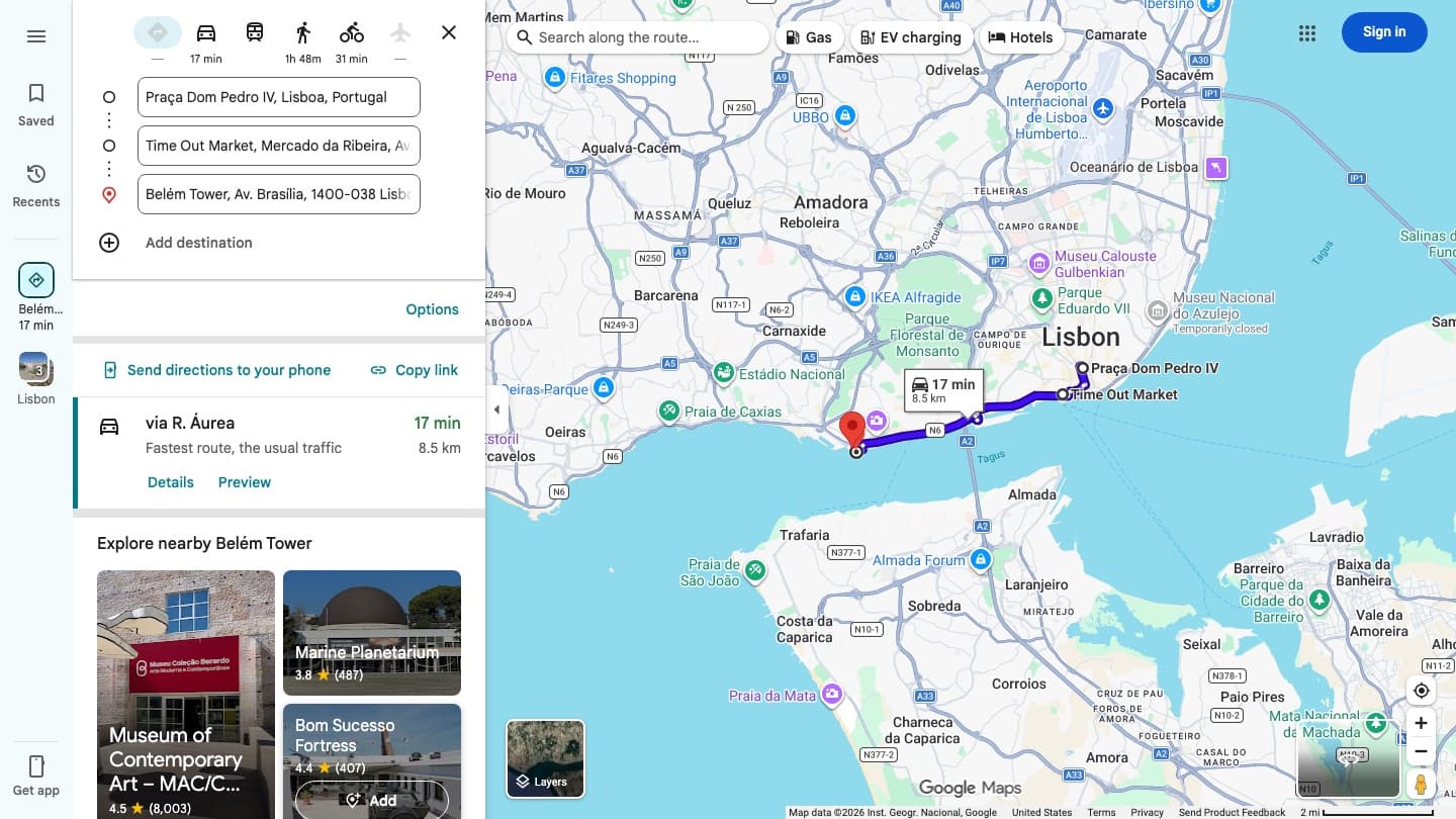
To make a custom route on Google Maps, open Directions, enter your starting point and destination, then click or tap Add destination to insert each stop in between. Google documents a ceiling of nine stops including the final destination, so a route can hold ten points in total counting where you start. That is the answer for a route you want to navigate today. If you want a route you can draw freehand, keep, and share next year, that is a different Google product called My Maps, and it works differently enough to be worth the rest of this page.
Custom route means two different things, and Google made two different tools
Most of the confusion around this question comes from one word doing two jobs. Before picking a method, decide which of these you actually want, because the tools do not overlap much.
- A route with stops. You want to leave from one place, call at two or three others, and end somewhere. You want turn by turn navigation while you do it. This is ordinary Google Maps Directions, and it is the right answer perhaps nine times out of ten.
- A route you draw and keep. You want to trace a line that follows no particular set of directions, label it, add notes, keep it for months and send it to someone. This is Google My Maps, a separate product with a separate address.
The practical difference: the first one navigates but forgets, the second one remembers but does not navigate. Nearly every complaint about Google Maps routes traces back to somebody using one while wanting the other.
Method 1: a custom route with multiple stops
This works the same on a phone, in a phone browser, and on a computer, with the buttons in different places. On a computer:
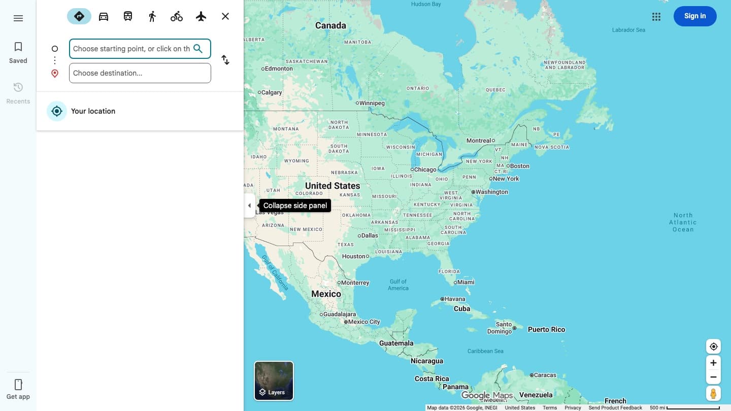
- Open Google Maps and click Directions. You get two empty fields, a starting point and a destination.
- Fill both in. The route appears immediately, along with the travel mode icons across the top.
- Click Add destination underneath. A third field appears. Repeat for each stop you want.
- Drag the stops by their handles to reorder them. Google recalculates as you go.
One detail worth knowing before you type: Google resolves what you enter to its own canonical name for the place, and the two are not always the same. Entering Rossio Square in Lisbon returns Praca Dom Pedro IV, which is the square's formal name and the one that appears in the route. Nothing has gone wrong. Check the resolved name rather than the name you typed, particularly for anywhere with a common tourist nickname.
How many stops you get
Google's own help page states it plainly: you can add up to nine stops, which includes the final destination. Counting the point you start from, that is ten places on one route.
This number is worth checking against whatever else you read, because several of the highest ranking pages for this question say ten stops rather than nine plus a start. The distinction only matters at the boundary, but at the boundary it matters quite a lot: if you plan for ten stops plus an origin, you will find yourself one field short with the trip already sketched out.
Making the same route on a phone
The phone app hides the stops behind a menu, which is the single most common reason people conclude it cannot be done. The route is built in the same order, but Add destination is not on screen. Google's steps for the app are:
- Open Google Maps and search for your destination, or tap it on the map.
- At the bottom left, tap Directions.
- At the top right, tap More, the three dot menu, then Edit stops. This is the step that is easy to miss.
- Add your stops, up to the same nine including the destination.
- To change the order, hold Reorder next to a stop and drag it up or down.
- When you are finished, tap Done.
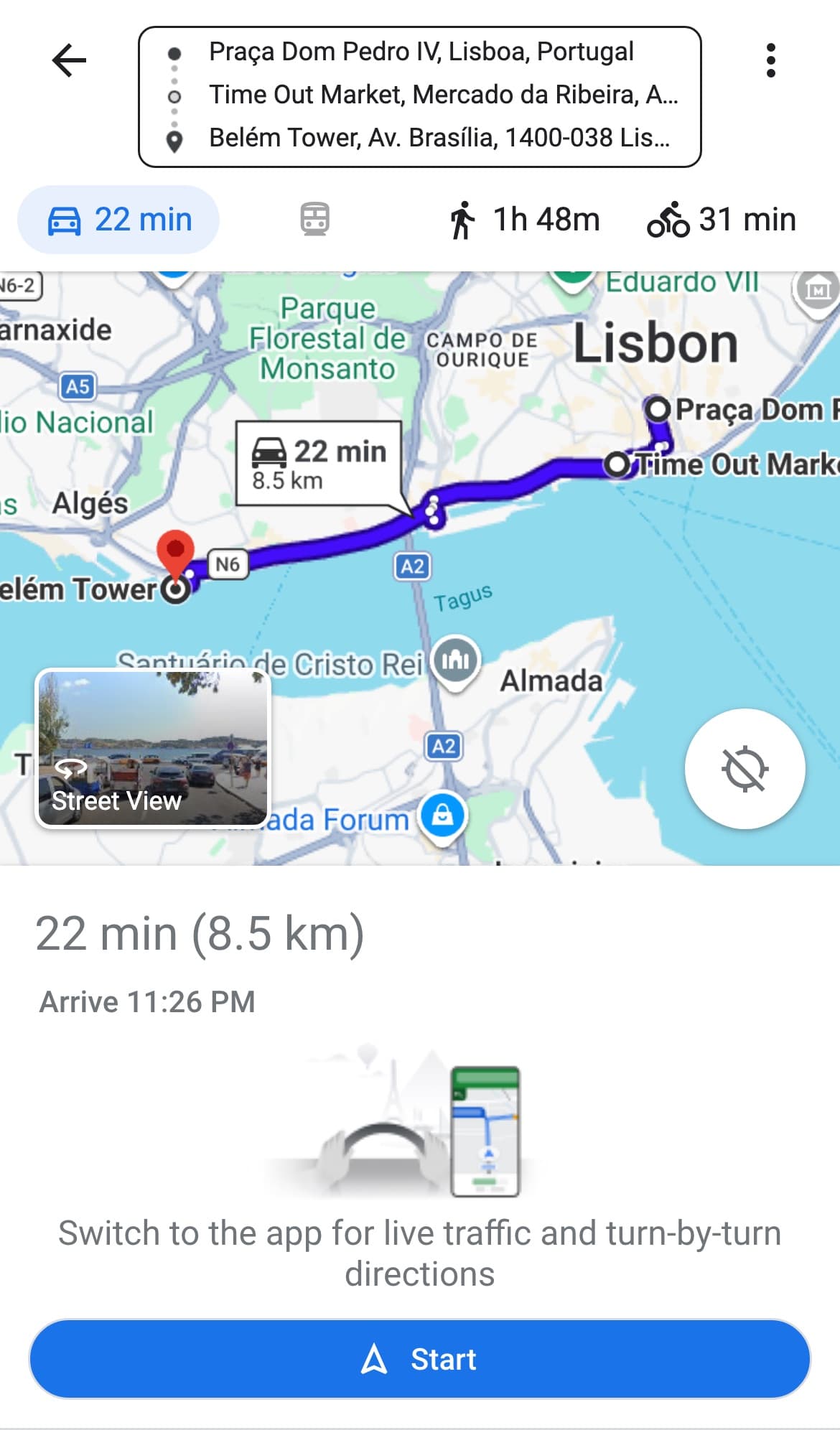
A phone browser behaves differently again. There is no app menu, so the most reliable route on mobile web is to build the route on a computer and use Copy link, or to open a directions URL directly. The phone screenshot above is mobile web, not the app, and the difference is visible: it offers a Start button and a line reading "switch to the app for live traffic and turn by turn directions", because the browser version does not do turn by turn itself.
Changing the line the route takes
Adding stops changes where the route goes. Dragging changes how it gets there. If Google has routed you along a motorway and you would rather take the coast road, you do not need a new stop for it.
On a computer, click and hold any point on the blue route line and drag it to where you want the route to pass. Google reroutes through that point and keeps it as you continue. Two limits apply, and both are easy to hit without understanding why:
- Driving only. Google documents drag to reroute for driving directions. Walking and cycling routes do not offer it.
- Computers only. There is no equivalent gesture on the phone app or the mobile web version. On a phone, an extra stop in roughly the right place is the substitute.
Why transit and flights refuse to take stops
If you build a multi stop route and then switch to public transit, the time estimate vanishes. This is not a bug and it is not a loading delay. Google states that multiple destinations work for all modes of transportation except public transit or flight.
You can see it in the desktop screenshot at the top of this page. The driving, walking and cycling icons each carry a time. The transit icon and the flight icon carry a dash instead, on a route that is perfectly valid for the other three modes.
For a city day built around trains, trams or buses, the workaround is unglamorous but reliable: plan the order of the stops yourself, then ask for transit directions one leg at a time. Timetables make the middle legs unpredictable anyway, so a single optimized transit chain would be a worse answer than it looks.
Method 2: My Maps, for a route you want to keep
Everything above produces a route that exists while you are looking at it. Search for something else and it is gone. If you want the route itself to persist, you need My Maps, which is at google.com/mymaps and is a genuinely separate product from the Google Maps you navigate with.
What it does that Directions cannot:
- Draw freehand. Click a start point, click each bend, double click to finish. The line goes where you put it, whether or not a road is there.
- Hold far more than ten points. Google puts the ceiling at 2,000 lines, shapes or places per layer, and 10,000 per map.
- Organize into layers. Each set of directions gets its own layer, so a week long trip can keep one day per layer.
- Persist and share. The map is saved to your Google account and stays until you delete it.
Drawing the line
Drawing is the feature that has no equivalent anywhere in ordinary Google Maps, and it is worth the trip to a laptop for a walking route, a trail, or anything that does not follow a road. The steps:
- Open google.com/mymaps and click Create a new map.
- Click Add line or shape in the toolbar under the search box, and pick the layer it belongs to.
- Click once where the line starts.
- Click each corner or bend along the way. Every click sets a point, so a curved path is a series of short straight segments.
- Double click to finish, or click back on the first point to close a shape.
- Give it a name and click Save.
To get a real routed line instead of a drawn one, use Add directions instead, which creates a new layer and asks for a start and an end. Each set of directions occupies its own layer, which is why a trip with four driving days ends up as four layers rather than one.
The catch, and it is a real one
My Maps is built for a computer. Google's own help page for drawing lines and shapes says, in its Android section, My Maps is not available for Android, but you can view your My Maps using Google Maps on your computer.
It is also account bound in a way Directions is not. You can plan an entire multi stop route in Google Maps without signing in to anything. Open My Maps on a phone browser while signed out and you do not get a map at all. You get this:
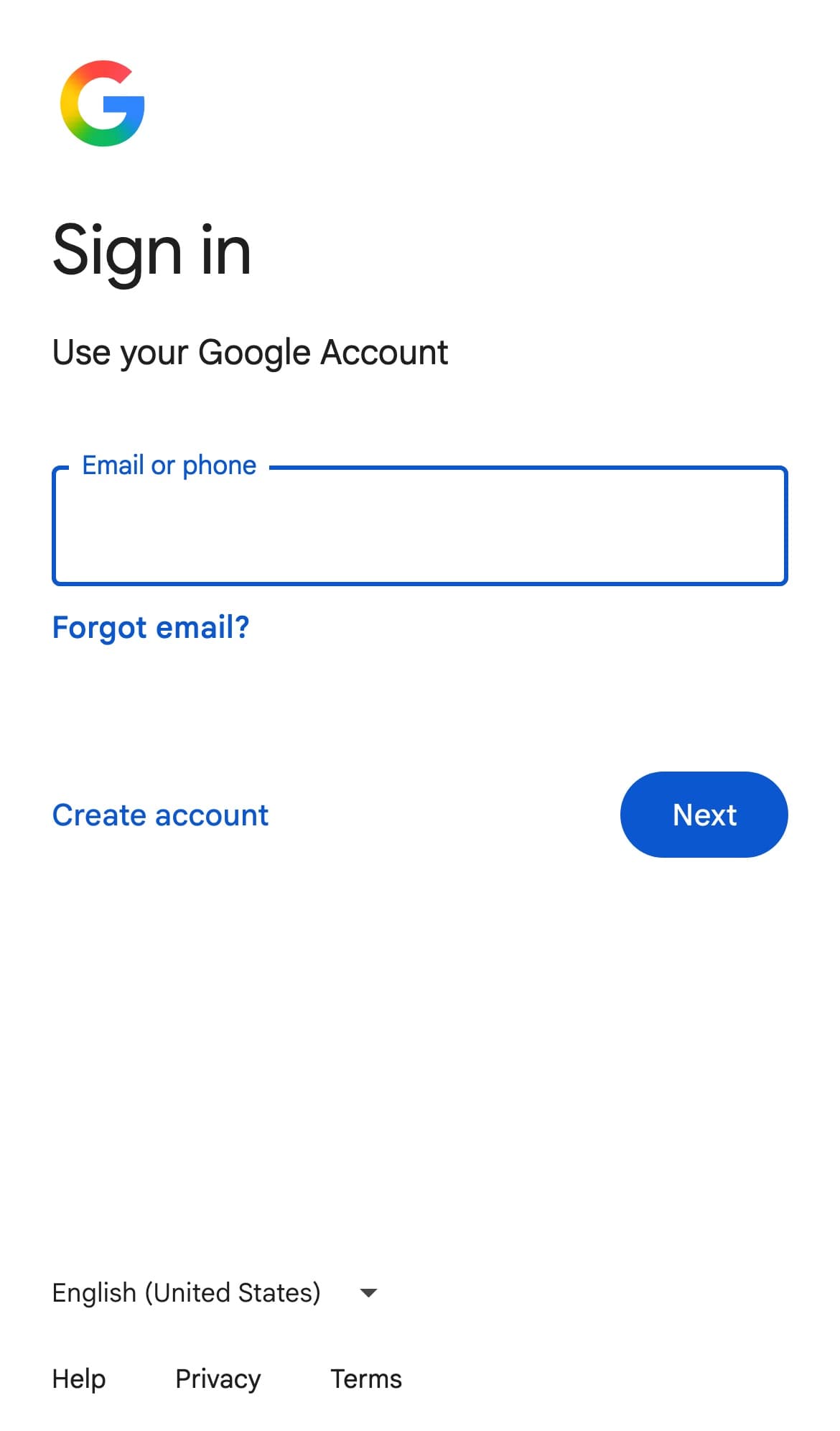
That screen is the honest summary of the whole tool. My Maps is something you sit down and build before a trip, on a laptop, signed in. It is not something you reach for on a platform with four minutes to spare.
Which one to use
| Directions with stops | My Maps | |
|---|---|---|
| Turn by turn navigation | Yes | No |
| Maximum points | 9 stops plus your starting point | 2,000 per layer |
| Draw a line freehand | No | Yes |
| Survives closing the tab | No | Yes |
| Needs a Google account | No | Yes |
| Works on a phone | Yes | Not on Android, per Google |
| Best for | Today's driving | Next month's trip |
If you are leaving in an hour, use Directions and add stops. If you are planning something in three weeks that you want to send to the people coming with you, build it in My Maps on a computer, then use Directions on the day to actually drive it. Using both, in that order, is the normal answer rather than a compromise.
The part a route is genuinely bad at
Both methods assume you already know which places you are going to. They are tools for ordering and connecting a set of destinations, and neither has an opinion about whether the destinations are any good.
For a trip, that is usually the harder half of the problem. The Lisbon route in the screenshots above is three points long and took under a minute to build. Deciding that those three were worth a day, out of everything in the city, is the part that takes an evening of reading and still leaves you unsure.
Which suggests the sensible order of operations: settle the list first, then route it. A route built from places you chose carelessly is an efficient way to reach the wrong restaurants.
Going somewhere else? There are lists built the same way for every city we cover. If Lisbon is the trip, there is a longer read on where to eat in Lisbon, and if you are still collecting places rather than connecting them, the companion piece on pinning a location and actually keeping it covers the step before this one.
Common questions
- How do you make a custom route on Google Maps?
- Open Google Maps and click Directions, enter your starting point and your destination, then click Add destination to insert each stop in between. On the phone app the same control is hidden: tap Directions, then More at the top right, then Edit stops. Drag the stops to reorder them. Google allows up to nine stops including the final destination, which is ten points counting where you start.
- How can I make a route on Google Maps with more than 10 stops?
- You cannot in ordinary Google Maps directions, which stop at nine stops including the destination. For more than that, use Google My Maps at google.com/mymaps, where a single layer holds up to 2,000 lines, shapes or places and a map holds up to 10,000. The trade off is that a My Maps route is for planning and sharing, not for turn by turn navigation, and Google states that My Maps is not available on Android.
- Can you draw your own route on Google Maps instead of following roads?
- Not in Google Maps itself. Use My Maps on a computer: click Add line or shape, click where the line starts, click each bend along the way, then double click to finish and give it a name. Every click sets a point, so a curve is drawn as a series of short straight segments. This is the only Google tool that will put a line where there is no road.
- Why can I not add multiple stops to a transit route?
- Because Google does not support it. Its help page states that directions to multiple destinations work for all modes of transportation except public transit or flight. On a multi stop route the driving, walking and cycling icons each show a travel time while the transit and flight icons show only a dash. For a transit based day, plan the order of stops yourself and request directions one leg at a time.
- How do I share a custom route with someone else?
- For a directions route, use Copy link in the left panel on a computer. The URL contains every stop in order and rebuilds the whole route for whoever opens it, with no account needed on either end. Send directions to your phone pushes it to the Google Maps app on a device signed in to the same account. A My Maps route shares like a document, through the Share button, with view or edit access.